Twenty thousand aircraft that cannot see each other: how a drone light show works
Drop this at dinner: A drone show is twenty thousand aircraft that can't see each other, flown by one person who isn't flying any of them; the whole thing is a timetable solved in advance, and each drone only has to know where it is to two centimetres.
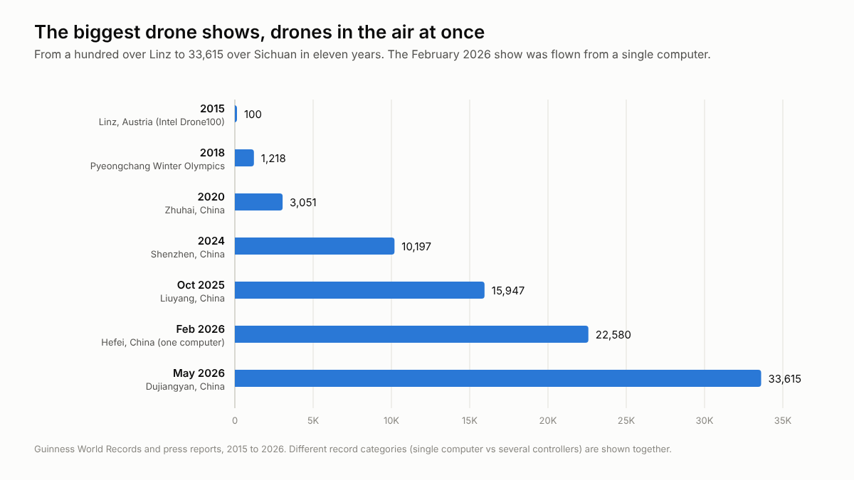
Thursday 5 November is Bonfire Night, and a growing share of the sky that evening will be drones rather than gunpowder. Truro has cancelled its display for the second year running, citing the cost of meeting the standards of Martyn's Law early. Alexandra Palace is putting hundreds of choreographed drones up before its fireworks on 7 and 8 November. And the form itself keeps leaping: 1,218 drones at the 2018 Winter Olympics in Pyeongchang, 10,197 over Shenzhen in September 2024, 15,947 over Liuyang in October 2025, 22,580 flown from a single computer over Hefei on 3 February 2026 for China's Spring Festival Gala, and 33,615 over Dujiangyan in Sichuan on 20 May 2026.
Nobody is flying anything
The surprising thing is what those drones cannot do. They cannot see each other. A show drone has no camera and no collision avoidance, just a bright LED, a satellite receiver and a radio. The whole show is solved weeks in advance as a timetable in four dimensions. Choreography software gives every drone a path through space and time such that no two paths ever come within a set spacing of one another, runs the lot in simulation, and uploads the result to the fleet. On the night a single command launches the swarm, and from then on each drone flies its script while the control computer watches telemetry: position, battery and health. If a drone reports a fault, that one aircraft is sent to land and the picture closes over the gap.
When the timetable itself is wrong, it goes wrong at once. In Orlando in December 2024 drones that had lost their flight-path data collided and fell on the crowd, and a seven-year-old boy needed heart surgery. The safety of a drone show lives in the planning, not in the aircraft.
Knowing where you are to two centimetres
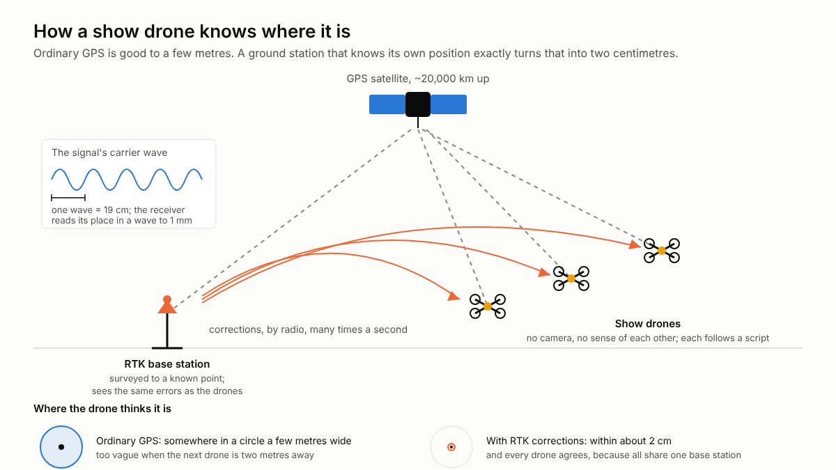
So the real problem is position. Ordinary GPS, the kind in a phone, is good to a few metres, which is ruinous when the next drone is two metres away. The fix is RTK, real-time kinematic positioning. A receiver normally times a code carried in the satellite's signal to work out its distance from the satellite, and that timing is noisy. But the code rides on a carrier wave about 19 centimetres long, and a receiver can read its position within one wave to a millimetre. What it cannot tell on its own is how many whole waves lie between it and the satellite.
That is where the base station comes in. A receiver on the ground, surveyed to a precisely known point, sees the same satellites through the same atmospheric distortion as the drones, works out the errors, and broadcasts corrections to every drone many times a second. With those corrections the maths resolves the count of whole waves, the fix, and from then on each drone knows its position to about two centimetres. The precision is relative to the same ground station rather than absolute, which is exactly what a formation needs: it matters less where the swarm is than that every drone agrees.
Sources
This piece was drafted by AI from the public sources named, then read and approved by Michael Rossi before it went up. It explains how something works; it is not advice of any kind.
← Back to StreetOwl